Warm Tuesday With Late Storm Chances
A warm & pleasant day across the state. High temperatures reaching the 70s & 80s under partly sunny skies. The warmer spots will be across SE Nebraska. A Pop up shower or two will be possible near 5-7pm across eastern, NE.

Another BELOW AVERAGE day across the state! Highs only reaching the 70s out west and 80s farther east. Enjoy these temperatures before the weekend comes around!

Wednesday night-Thursday SEVERE WX:
Storms will look to form out west Wednesday evening, carrying a LARGE hail, DAMAGING wind & brief tornado threat. By late Wednesday into early Thursday, storms will move ESE along & south of I-80 weakening with time, carrying heavy rain & gusty winds. The LLJ will be primed near the NE/KS border, meaning gusty winds & small hail will be possible with any overnight storms.

7-9PM: Storms will form out west near Scottsbluff, Imperial & McCook, carrying a LARGE hail, STRONG wind & TORNADO threat. *Storm motion will be ESE*

10PM-1AM: Storms will push ESE along & south of I-80, with the strongest storms south of Kearney. Some small hail & gusty winds will be associated with these storms.

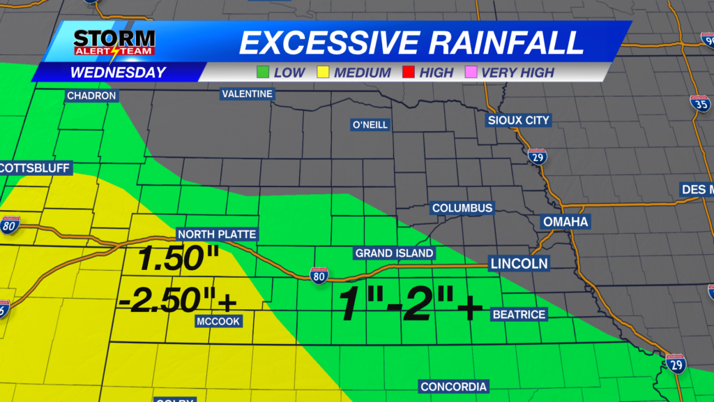
Areas of flooding will also be a concern across much of SW Nebraska through the next 48 hours. Rainfall totals up to 2-4″+ will be possible within these slow moving storms.

A level 2 risk for EXCESSIVE RAINFALL is in place for SW Nebraska through tonight. 2-4″+ of rainfall could occur within these slow moving storms.

Isolated afternoon rain/T-storms across the state Wednesday. Thursday morning could bring some lingering rain across eastern Nebraska before staying cloudy & cool. A HOT & HUMID weekend ahead with spotty rain/storm chances next week.

Meteorologist Houston Hall
Facebook: HHallWX
YouTube: HHallWX


