Eastern Nebraska under tornado watch
 LINCOLN, Neb. (KLKN) — A tornado watch is now in place for eastern Nebraska through 11 p.m. Wednesday.
Strong to severe storms are going to be possible into Thursday morning.

The areas at risk for severe weather are shaded in green, yellow and orange. The area with the highest risk is in the Enhanced Risk area, shaded in orange.
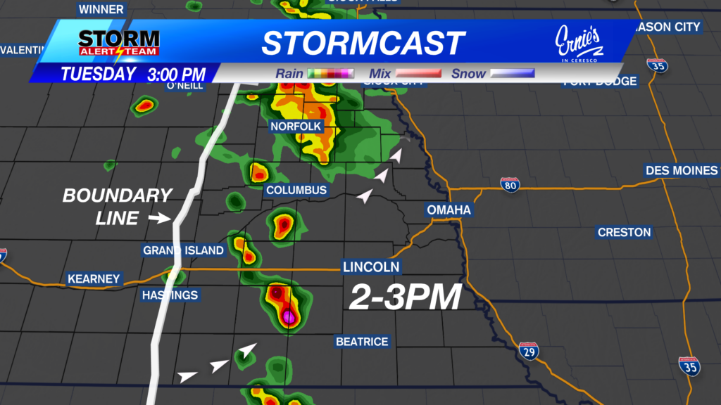
Above is the latest model run of StormCast.
Storms form early in the evening in southeast Nebraska, then quickly move east.
A second wave moves through overnight, bringing more chances for severe weather. This second wave won’t have as much to work with, so the overall severity should be less than the early evening severity.
Still, severe storms are possible overnight, so being prepared is key.

The overall tornado risk is 2% to 5%.
Storms that form in the early evening will have the potential for spin-up tornadoes.
The overnight storms will have a smaller (but not zero) chance for tornadoes.

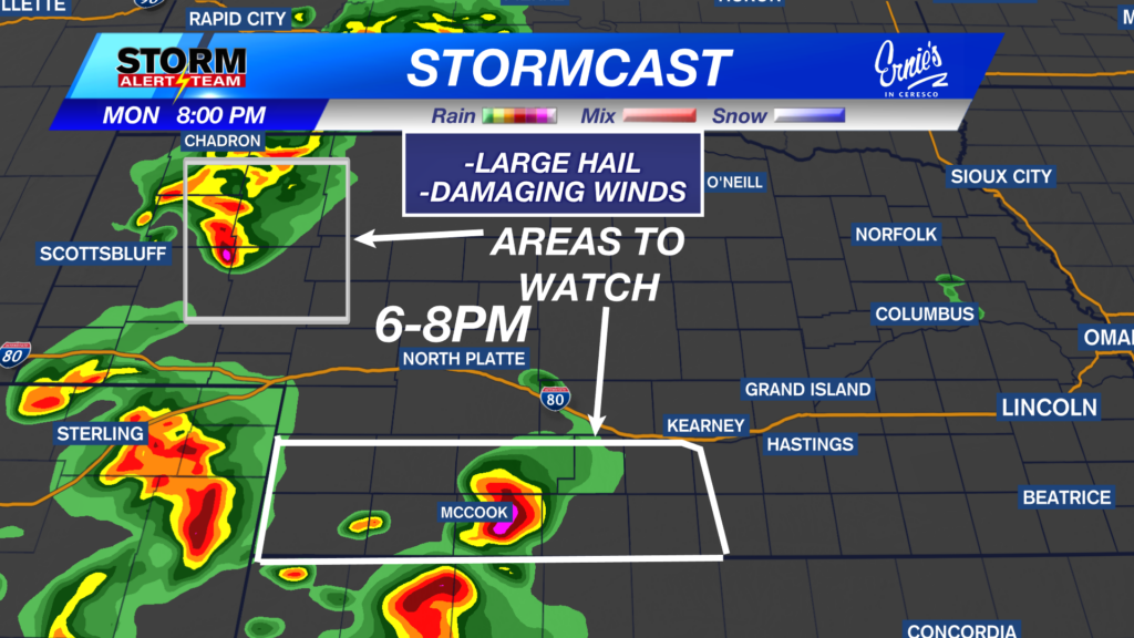
Large hail is going to be our main concern.
Many areas may see 1-inch in diameter hail, with isolated golf ball to baseball-size hail possible in the red and yellow shaded areas.

Damaging wind is also going to be threat with storms that form. Wind gusts in excess of 70 mph will be possible in the red and yellow shaded area.
Chief Meteorologist Rusty Dawkins
Twitter: RustyWx
Facebook: RustyWx
YouTube: RustyWx