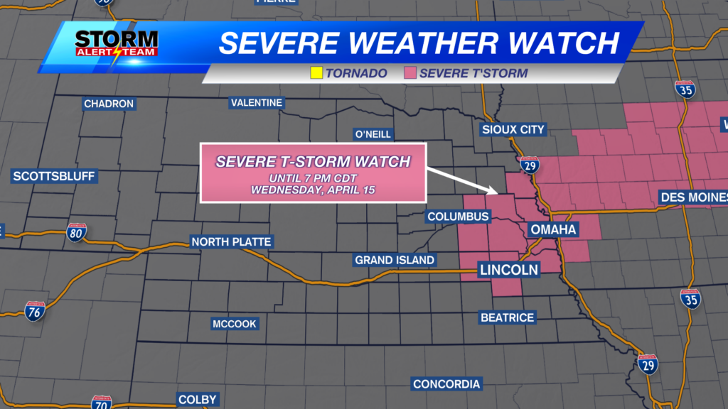
Storm chances into Wednesday
A SEVERE THUNDERSTORM WATCH is in place for north central and northeast Nebraska through 2:00am Wednesday, July 18, 2023.
Hail and damaging wind will be possible into the early morning hours for this area.
A few storms will be possible Tuesday night across much of Nebraska, but the better chance comes our way Wednesday afternoon. Strong to severe storms will be possible. After that, we quiet down for a while and REALLY warm up next week.
For tonight (Tuesday into early Wednesday) there is a Marginal Risk for most of the state and a Slight Risk for NW Nebraska. An isolated storm or two may be severe.
For Wednesday, we start off the day dry with partly cloudy skies. We’ll eventually warm into the middle 80s by the afternoon.
As early as 1:00pm, storms will fire up in northeast Nebraska and start to drift south. These storms have the potential to become severe rather quickly.
Above, you will see that the storms will eventually drift south into SE Nebraska by late in the afternoon and early evening. See below for their potential.
There is a 2% risk for these severe storms to produce a tornado. That sounds small, and it is, but this also means that there’s a chance we’ll see a tornado somewhere in this green shaded area.
Large hail will be the biggest concern. Where you see those black dashed lines will have the chance at seeing hail bigger than golf balls.
Damaging wind will also be a possibility with the storms that move through.
Have a way to be alerted should severe weather move into your area. Do not rely solely on outdoor sirens, as they are meant for those outside and you may not be able to hear them, even if you are outdoors.
Chief Meteorologist Rusty Dawkins
Twitter: RustyWx
Facebook: RustyWx
YouTube: RustyWx


