Storms possible and cooler, but heat is headed our way
SEVERE THUNDERSTORM WATCH: June 24-25, 2026

A Severe T-storm Watch is in place for parts of south central and SW Nebraska through 2AM Thursday, June 25th. A Tornado Watch continues in the panhandle until 11pm MDT Wednesday.
For up to the minute radar, go HERE.
For the latest warnings, go HERE.
For a live look at our Nebraska Weather Cams, go HERE.
And we would love to see video of any storm footage you may get (safely!). You can upload that using our Now Local News App HERE.
It will be much cooler on Thursday, then a little warmer on Friday. The heat will then get cranked up for the weekend and beyond! Storms are possible, but mainly on Thursday.

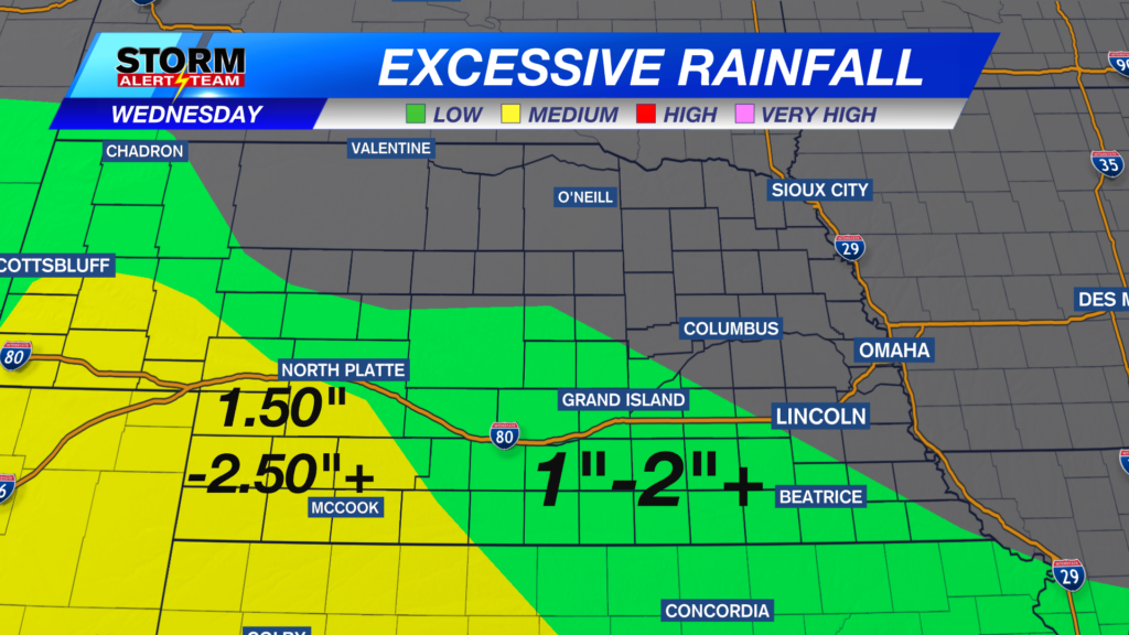
Storms are possible Wednesday afternoon and evening for portions of western Nebraska.

Storms will be moving into SW Nebraska around sunset. Hail, damaging wind, and isolated tornadoes are possible.

Highs will only be in the 60s and 70s on Thursday. That’s 10 to 20 degrees below average.

Storms are possible Thursday, with the higher severe weather risk in the western portion of Nebraska.
Above is what our StormCast weather model is saying for timing, duration, and location of the storms.

Chief Meteorologist Rusty Dawkins
Facebook: RustyWx
YouTube: RustyWx
TikTok: RustyWx
BlueSky: RustyWx
Instagram: RustyWx
Threads: RustyWx
Twitter: RustyWx