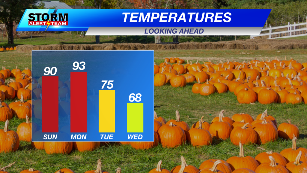
Cooler air is on the way
Cooler air is moving in and the extreme heat from the previous days will soon be a distant memory. Rain chances are increasing, too.

For Tuesday, highs will be in the 50s, 60s and 70s. A fall feel to the forecast!

With this transition comes the obligatory severe weather chance as a cold front moves through. This will mainly affect areas to our southeast.

The best chance for storms in SE Nebraska will kick in late Tuesday afternoon into the evening hours. If storms can get strong enough, hail and damaging wind would be the main concern.

Chief Meteorologist Rusty Dawkins
Facebook: RustyWx
YouTube: RustyWx
TikTok: RustyWx
BlueSky: RustyWx
Instagram: RustyWx
Threads: RustyWx
Twitter: RustyWx