SEVERE Storms Friday Night
Severe storms are LIKELY Friday evening/night across SE Nebraska! Concerns: Winds up to 75+ mph, LARGE HAIL, isolated tornadoes & Flash flooding
For up to the minute radar, go HERE.
For the latest warnings, go HERE.
For a live look at our Nebraska Weather Cams, go HERE.
And we would love to see video of any storm footage you may get (safely!). You can upload that using our Now Local News App HERE.

My thoughts: First storms develop near Red Cloud & uses lots of storm fuel. Farther north and east, storm fuel will be HIGH/EXTREME with storms forming along that line. By the evening, storms move ESE carrying the STRONG WIND & isolated tornado potential. Storms will be out by 2am with a few lingering showers/T-storms early Saturday morning.

Near 6-8pm: The first storms will try & develop near Red Cloud-> up to Fremont. These first storms will have the best chance for all hazards. LARGE HAIL, STRONG WINDS & TORNADOES. Storms will move ESE through tonight.

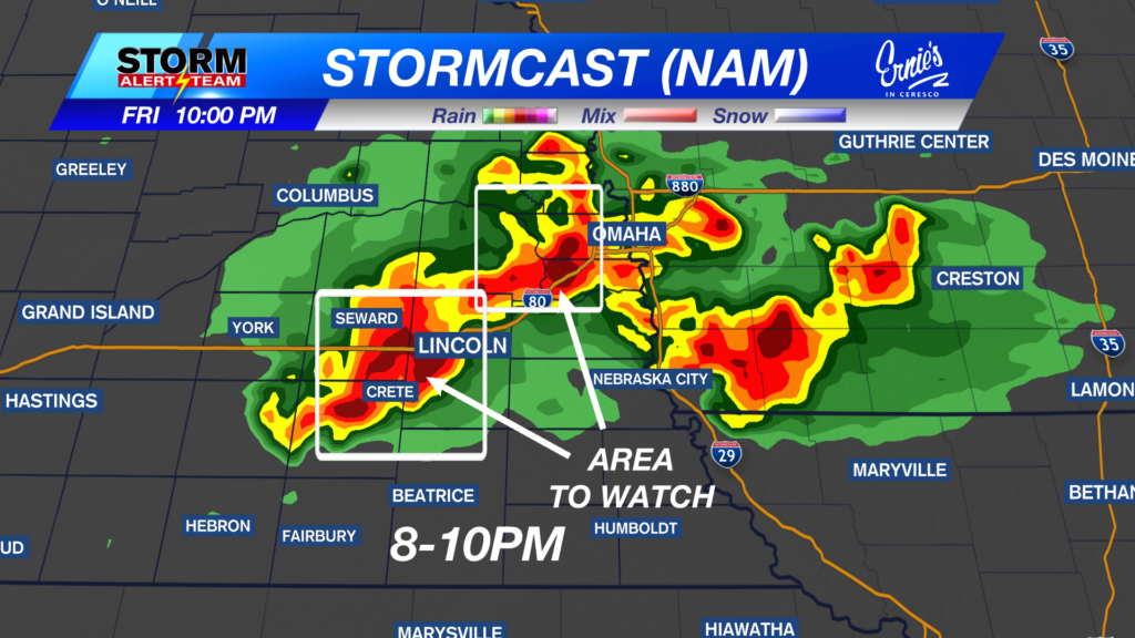
8-10PM: Storms will carry a DAMAGING WIND & tornado threat. Lincoln, Omaha & SE Nebraska will likely see storms by 8-11pm Friday.

1-3am:Storms will continue through the overnight along/north of I-80 through 3-4am carrying mainly a hail/wind threat.

Flooding will be a concern through Friday night. Some spots could see 2-3″+ of rain due to storms staying stagnant for some time.

HOTTER temperatures farther SW will limit storms this evening. Highs reaching the 80s/90s across the state Friday afternoon.

VERY HUMID this afternoon & evening! Dew points reaching the mid 70s north and south of I-80. This will add to the storm fuel & intensification.

Storms with potential flooding concerns through Friday night. Saturday will be partly sunny with a chance of isolated storms by the afternoon and evening. Sunday cools down due to afternoon showers/T-storms. Next week will be HOT & HUMID!

Meteorologist Houston Hall
Facebook: HHallWX
YouTube: HHallWX


