SEVERE Storms Likely Thursday Night
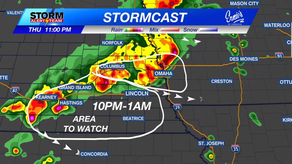

Strong storms capable of 60-70+ mph winds, quarter to half dollar size hail, a brief spin up & flooding will move NW->ESE this evening into early Friday morning. A Severe Thunderstorm Watch is in effect for central and western Nebraska until 9 p.m. CDT on Thursday, July 30.
For up to the minute radar, go HERE.
For the latest warnings, go HERE.
For a live look at our Nebraska Weather Cams, go HERE.
And we would love to see video of any storm footage you may get (safely!). You can upload that using our Now Local News App HERE.

6-9pm: Strong/severe storms will occur from O’Neil down to Lexington. All hazards will be possible: 65+ mph winds, a brief spin up, hail & heavy rainfall.
-Watching areas near Ord, Lexington & Columbus.


A few brief spin ups will be possible within the line of storms this evening/night. 7pm-11pm

The LLJ will enhance low level winds, which could create a few notches of rotation, especially on the southern tail end!

Through Friday morning, the rainfall potential will be very beneficial across all of eastern Nebraska. Some pockets of 3-4″ will be possible. The average rain totals will be around 1.0″-1.50″.

A hot & muggy day across Nebraska, with highs ranging from 87° – 100° with dew points in the 60s & 70s! A warm front will stall across SW Nebraska, hint the near triple digit heat.

Thursday brings morning showers/storms in SE Nebraska with severe weather from 4pm-midnight. Friday will feel PLEASANT due to drier air & breezy northeast winds! The weekend looks nice, warm and sunny. Next week will remain average with a refreshing cold front Tuesday-Wednesday. Morning lows could reach the 50s those two mornings!

Meteorologist Houston Hall
Facebook: HHallWX
YouTube: HHallWX