Rain & Storm Chances Increasing Thursday
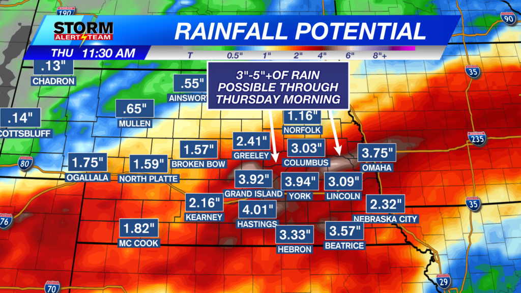
Some showers & T-storms will be possible across SE Nebraska this morning. This activity will continue through 11am-noon with the best rain chance from Lincoln & south!

A hot & muggy day across Nebraska, with isolated rain/storms from 2-8pm across eastern Nebraska. Highs ranging from 88° – 97° with dew points in the 60s & 70s!

Heat index values will peak around 97° – 108°+ for much eastern Nebraska.

2-4pm: A few hit and miss showers will begin to pop up across eastern Nebraska.

5-8pm: Isolated showers/T-storms will try and continue from O’Neil down to Tekamah.

Severe Weather Thursday: July 30, 2026
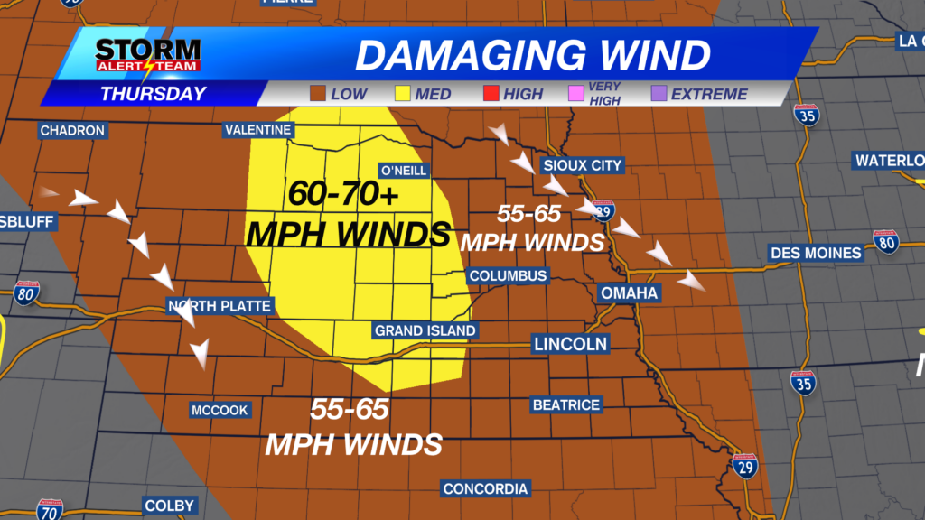
There is some UNCERTAINTY on the severe weather placement & timing due to potential rain/storms Thursday morning in SE Nebraska! This will play a big factor on the severe storm threat Thursday evening. Overall the severe weather timing will be from 4pm-midnight, with Lincoln/Omaha seeing storms near 8pm-midnight. Stay up to date for the latest!

4-7pm: A line of storms develops out west, carrying all hazards! Winds up to 60+ mph, hail, brief spin up & heavy rainfall.

7-9pm: Storms will likely be stretched from O’Neil down past the Tri-Cities. All hazards will be possible, with the strongest storms in NE Nebraska.

9-midnight: LNK/OMAHA will likely see rain/storms within this time frame. Main concern will be gusty winds, heavy rain & small hail.

Hot & humid Wednesday with pop up rain/storms from 2-7pm. Thursday could bring morning showers/storms in SE Nebraska with severe weather from 4pm-midnight. The weekend looks nice, warm and sunny. Next week will remain hot with a few mid week rain chances.

Meteorologist Houston Hall
Facebook: HHallWX
YouTube: HHallWX