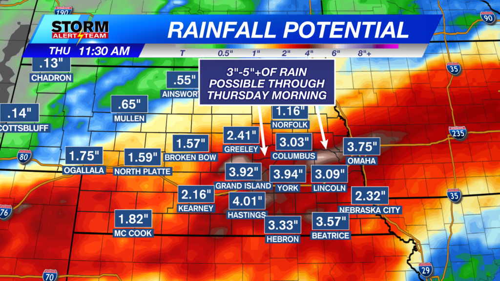
Rainfall potential Wednesday through Thursday
Rainfall is likely on and off through the next couple of days. The heaviest rain will fall in SE Nebraska during the 2nd half of the day on Wednesday.

We have a “Moderate Risk” for Excessive Rainfall in place for much of southeast and south central Nebraska Wednesday into very early Thursday. This red highlighted area has the highest chance for seeing ongoing heavy rain.

While the better chance for heavy rain is in southeast Nebraska, much of the state is in a Flood Watch, just in case. Heavy rain is still possible in the green shaded area.
Above is what our StormCast weather model is saying for timing, duration, and location of the storm chances Tuesday into Wednesday and Thursday.

Our afternoon high temperatures will be in the 60s and 70s for Wednesday.

Chief Meteorologist Rusty Dawkins
Facebook: RustyWx
YouTube: RustyWx
TikTok: RustyWx
BlueSky: RustyWx
Instagram: RustyWx
Threads: RustyWx
Twitter: RustyWx